


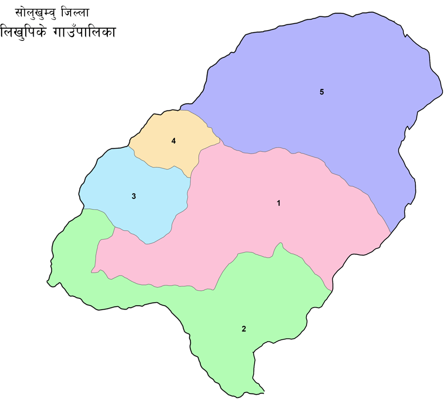
नेपालको काेशी प्रदेश अन्तर्गत पर्ने सोलुखुम्बु जिल्लाको दक्षिण-पश्चिम दिशामा अवस्थित लिखु पिके गाउँपालिका नेपालको एक हिमाली गाउँपालिका हो । नेपालको संविधान २०७२ ले अङ्गिकृत गरेको तीन तहको राज्य संरचना बमोजिम स्थानिय तह बर्गिकृत हुँदा सोलुखुम्बु जिल्लाका साविक गाउँ विकास समितिहरु गोलि, चौंलाखर्क र भकान्जेलाई समेटेर वि. सं. २०७३ फाल्गुण २७ गते लिखु पिके गाउँपालिका स्थापना गरिएको हो । विश्वसंम्पदा सुचिमा सुचिकृत नेपालको पहिचान सर्वोच्च शिखर सगरमाथा यसै जिल्लामा पर्ने हुँदा यस गाउँपालिकाको समेत बिशेष ऐतिहासिक महत्व रहेको छ ।
लिखु पिके गाउँपालिकाको भौगोलिक अवस्था :-
क्षेत्रफल:- १२४ .३८ वर्ग किलोमिटर
सिमाना :-
यस लिखु पिके गाउँपालिकाको पुर्वी सिमानामा सोलुखुम्बु जिल्लाकै सोलुदुधकुण्ड नगरपालिका पश्चिमी सिमानामा रामेछाप जिल्लाको उमाकुण्ड गाउँपालिका,उत्तरी सिमानामा सोलुदुधकुण्ड नगरपालिका र उमाकुण्ड गाउँपालिका रहेका छन भने दक्षिणी सिमानामा ओखलढुङ्गा जिल्लाको खिजीदेम्बा गाउँपालिका रहेको छ । यो गाउँपालिका प्रदेश नं. ३ सँग सिमाना जोडिएका स्थानिय तहहरु मध्यको एक हो ।
प्रमुख नदिनाला धार्मिक दर्शनिय स्थल:- यस गाउँपालिकामा सप्तकोशी नदिको एक सहायक लिखु नदि, किन्जा खोला, घट्टे खोला, खिम्जा खोला पिके क्षेत्र यस गाउँपलिकाको मुख्य पर्यटकिय क्षेत्रको रुपमा चिनिन्छ । यहाँबाट विश्वको अग्लो शिखर सगरमाथा लगएताका हिमालहरुको अवलोकन गर्न सकिन्छ । यस गाउँपालिका भित्र आफ्नै मौलिक विशेषता र महत्व रहेका विभिन्न धार्मिक तथा पर्यटकिय क्षेत्रहरुको पनि छन । देबी थान,बौद्ध,खवतरी कुल मन्दिर,गुरु रिम्पोक्षे गुम्बा,ओर्गेन साङ छोलिङ गुम्बा,चण्डी स्थान , सेती भुमे मन्दिर, लगाएत अरु धेरै धार्मिक स्थल हरु रहेका छन ।
Likhu Pike Rural Municipality is a mountainous rural municipality in Nepal, located in the southwestern direction of Solukhumbu District, under the Koshi Province of Nepal. When the local level was classified according to the three-tier state structure adopted by the Constitution of Nepal 2072, the former Village Development Committees of Solukhumbu District, Goli, Chaulakharka, and Bhakanje, were merged into Likhu Pike Rural Municipality on Falgun 27, 2073 BS. This rural municipality also has special historical importance as the highest peak of Nepal, Mount Everest, which is listed on the World Heritage List, is located in this district.
Geographical location of Likhu Pike Rural Municipality:-
Area:- 124.38 square kilometers
Boundaries
:-
This Likhu Pike Rural Municipality is bordered by Solududhkunda Municipality of Solukhumbu District on the eastern border, Umakunda Rural Municipality of Ramechhap District on the western border, Solududhkunda Municipality and Umakunda Rural Municipality on the northern border, and Khijidemba Rural Municipality of Okhaldhunga District on the southern border. This rural municipality is one of the local levels bordering Province No. 3.
Major rivers and religious tourist attractions:-
In this rural municipality, Likhu River, Kinja Khola, Ghatte Khola, Khimja Khola, a tributary of the Saptakoshi River, is known as the main tourist area of this rural municipality. From here, you can observe the mountains including the world's highest peak, Mount Everest. There are also various religious and tourist areas within this rural municipality that have their own unique characteristics and importance. There are many other religious sites, including Devi Than, Buddhist, Khawtari Kul Temple, Guru Rimpokshe Monastery, Orgen Sang Choling Monastery, Chandi Sthan, Seti Bhume Temple, and more.
